The Enigma of Article 121, Paragraph 3: The Way Forward?
The legal regime of islands has only stirred international attention since the creation of the exclusive economic zone and the delineation of the continental margin beyond 200 nautical miles offshore.
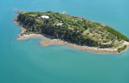
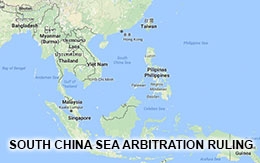
In conferences on the South China Sea these days the question whether a particular maritime feature is to be considered an island under contemporary international law able to generate, just as any other land area, an exclusive economic zone (EEZ) and continental shelf, is usually a hotly debated topic. Pictures of real maritime features, or sometimes even self-made creations of, for instance, maritime features with many, a few, two or finally one coconut tree on them are shown to the audience with the question whether they represent islands possessing an EEZ and continental shelf, after which the speaker usually answers that question himself. Unfortunately, international law is not developed by simply comparing quantitatively the number of scholar in favour or against a particular option with respect to a particular maritime feature.
The present contribution, which builds on recently conducted research by the present author will start out by looking into the genesis of the seemingly inextricable state of affairs (Part II). It will subsequently analyse the particular attention the Third United Nations Conference on the Law of the Sea (UNCLOS III) attached to this issue and the way these considerations finally found their way into the treaty language adopted at the end of almost a decade of negotiations (Part III). Finally the way forward will be addressed (Part IV).
Prolegomenae
The importance of islands under international law has fluctuated over time, but it is only since the creation of the EEZ and the precise delineation of the continental margin, two new concepts introduced during the UNCLOS III (1973-82), that the issue became a focal point of international attention. Up until then, reliance on the well-established principle of ‘la terre domine la mer’ proved sufficient for islands, just as land, to generate maritime zones off their coast. At a time when the territorial sea was still of limited extent, this equation did not particularly disturb the international community. Instead, the advantages attached to a possible dissociation could not compare to the disadvantages that would arise if islands were no longer put on an equal footing with land as far as the creation of maritime zones was concerned.
As The Anna decision of 1805 demonstrates, coastal State security was a guiding factor behind such assimilation. The ship was captured by an English privateer within the territorial sea of the United States, at least when measured from a little mud island near the mouth of the river Mississippi ‘composed of earth and trees drifted down by the river, which form a kind of portico to the mainland’. After the ship had been brought across the Atlantic for adjudication before a British prize court, the judge nevertheless was of the opinion that the protection of the territory started from these islands for ‘the right of dominion does not depend upon the texture of the soil’, his main concern being that otherwise other powers might occupy, embank and fortify such mud islands, possibly leading to control over the river itself.
The idea that islands are to be treated as land also started to surface in treaty arrangements between States in the area of fisheries. As fish species do not discriminate between land and islands when choosing their preferred habitat in shallow waters, it became important for States to determine their exclusive fishery jurisdiction from their coasts with more precision in order to avoid conflict with fishermen from other countries. In the North Sea, for instance, when it became necessary to regulate the policing of fisheries on a regional basis during the late 1900s, it was stipulated that the coasts of the respective countries also included ‘the dependent islands and banks’.
This purely coastal State-oriented approach, however, started to generate serious concerns once it became clear during the UNCLOS III negotiations that the spatial dimension of coastal State jurisdiction over maritime space was radically to expand. From a territorial sea of three nautical miles, which for a long time was believed to represent a rule of customary international law by many States, maritime zones at present extend up to 200 nautical miles (EEZ) and even beyond that distance in the case of extended continental shelves on the basis of the United Nations Convention on the Law of the Sea. A tiny rock in the middle of the ocean, with no other terra firma located within a range of 400 nautical miles, has the potential today to generate a maritime area in excess of 125.664 square nautical miles or 431.014 square kilometres. With respect to the sea-bed and subsoil this area can even be substantially larger if the feature in question is located in a totally isolated area.
...
Prof Dr Erik Franckx is currently a Research Professor at the Vrije Universiteit Brussel (VUB), and Director of its Centre for International Law. An internationally acclaimed expert on the Law of the Sea, he sits on the Advisory Body of Experts on the Law of the Sea of the International Oceanographic Commission, and on the roster of Experts in Marine Boundary Limitation of the International Hydrographic Organization. In 2006, he was appointed to the Permanent Court of Arbitration in The Hague.
The paper was presented at the High-level Workshop: "Maritime Issues and United Nations Convention on the Laws of the Sea: Sharing European and Asia Approaches to Territorial Disputes", 4-5 June 2015, Halong Bay, Vietnam. This workshop is co-organized by Diplomatic Academy of Vietnam (DAV) and EU Delegation in Hanoi through EU-Vietnam Strategic Dialogue Facility.